Click HERE to read the article
In an editorial on May 29, William H. Stewart listed off what he thinks are the causes for the decline in the CNMI economy. He correctly identifies one of those causes as “lagoon pollution and ‘red flagged’ beaches.” But inexplicably, three sentences later he blames “burdensome and restrictive environment laws.” That makes no sense. If the lagoon is polluted, which it certainly is, then the environmental laws must be inadequate or not properly enforced. If the environmental laws were truly “burdensome and restrictive,” then the waters surrounding Saipan would be crystal clear and teaming with fish. So which one is it? I think we all know the answer.
Mr. Stewart is correct to point out some of the CNMI’s problems, for if we don’t know what the problems are, then how can we fix them? However, he mistakenly assumes that if there were fewer environmental regulations and fees that more foreign investors would create new businesses. Even if some foreign investors were to somehow benefit from relaxed environmental standards, which they won’t, it would be at the expense of the local dive shop operators and local fishermen. The way things are now, with our supposed “burdensome and restrictive” environmental laws, every time we have a heavy rain, divers are unable to go diving and fishermen are unable to go fishing due to the overloading of sediment and pollutants in stormwater runoff caused by poor land use practices and illegal burnings. Sometimes they can’t go out for days. Do we really want to make that situation worse?
The CNMI’s tourism industry and many local culturally important practices, such as fishing with a talaya or a spear, are dependent upon a healthy environment. With or without JAL, tourists will not visit the CNMI if the health of our coral reefs decline or if the Saipan Lagoon is too polluted to swim in. Money spent on protecting our coral reefs and our environment shouldn’t be seen as a hindrance to economic development; they should be seen as an investment in the future of the CNMI economy. It would be folly to assume otherwise.
Angelo Villagomez
Coral Reef Public Involvement Coordinator
Marianas Resource Conservation & Development Council
Monday, May 29, 2006
Sunday, May 28, 2006
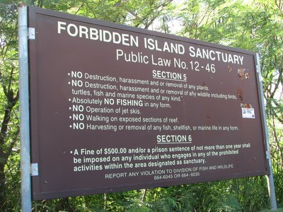
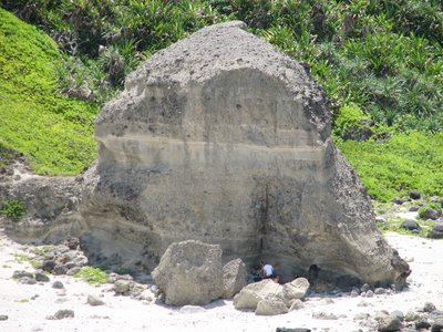
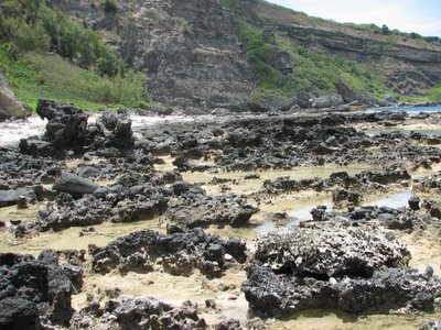
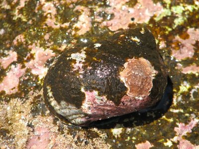
Forbidden Island
The Forbidden Island Sanctuary was created in 2000 with the enactment of Public Law #12-46. It stretches from Tank Beach on the north side of the Kagman peninsula, around to Forbidden Island Beach, and hugs the shore around to just south of the Lao Lao Bay Golf Resort.
Here are some pictures:

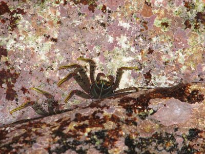
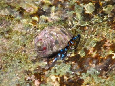
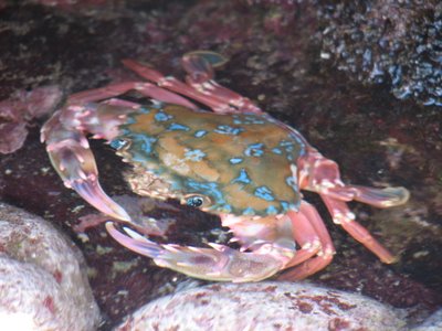 Now you see him:
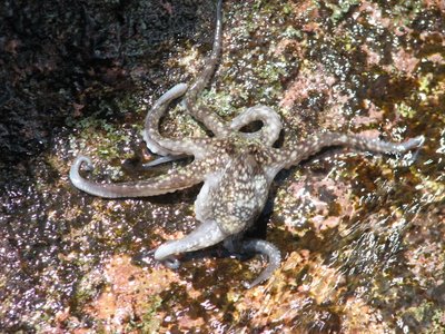 Now you don't:
 As soon as he crawled out of the sun and into the shade he changed colors. Isn't that camouflage amazing?


Here are some pictures:


 Now you see him:
 Now you don't:
 As soon as he crawled out of the sun and into the shade he changed colors. Isn't that camouflage amazing?


Thursday, May 25, 2006
What does burning do to the soil?
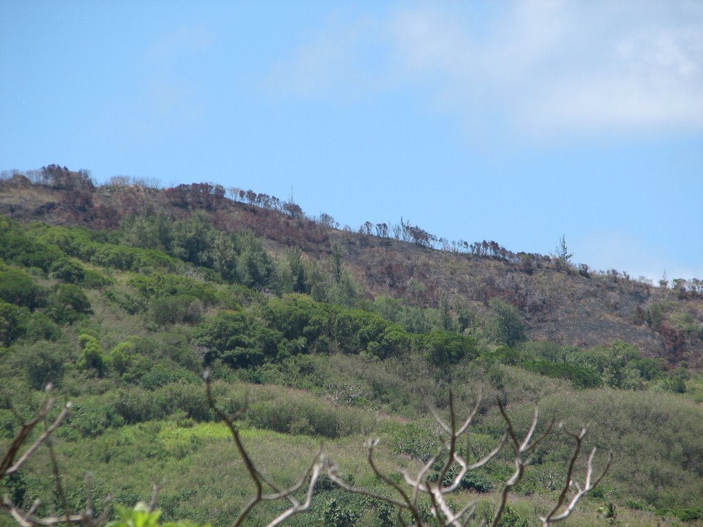
This is what the Lao Lao watershed looked like a few weeks ago:
 Here is a photo (taken this week) of pretty much the same area after a recent burn:
 The first photo was taken just downhill from the second photo, but they both show pretty much the same spot. In the first photo, there are lots of grasses and a few trees covering the hill (but not much swordgrass). In the second photo, there is almost no cover and the trees look like they are dying. This area burned a few weeks ago.
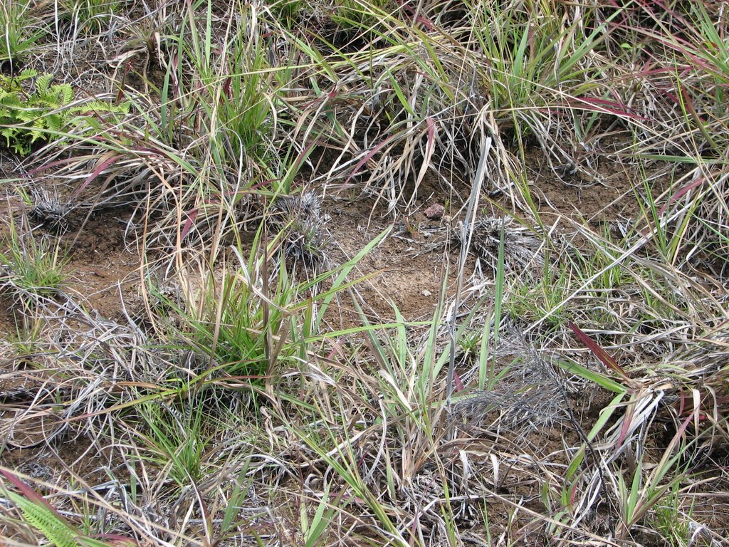
At first glance, you might think that the post-burning photo looks nicer. The ground isn't covered by all those weeds and it looks like a pretty nice lawn (a lawn on an extremely steep slope).
Let's take a closer look
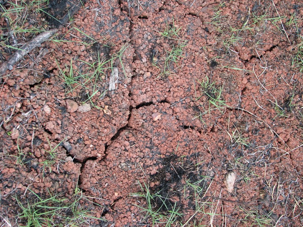
When I inspected the Lao Lao revegetation site a few weeks ago (on April 27, before the burnings), the soil looked like this:
 I'm not a soil scientist, but from the color, one can deduce that it is composed of mainly clay. Clay is made up of very fine particles. The soil looks dry, but it looks like it has some moisture (hence, the grass).
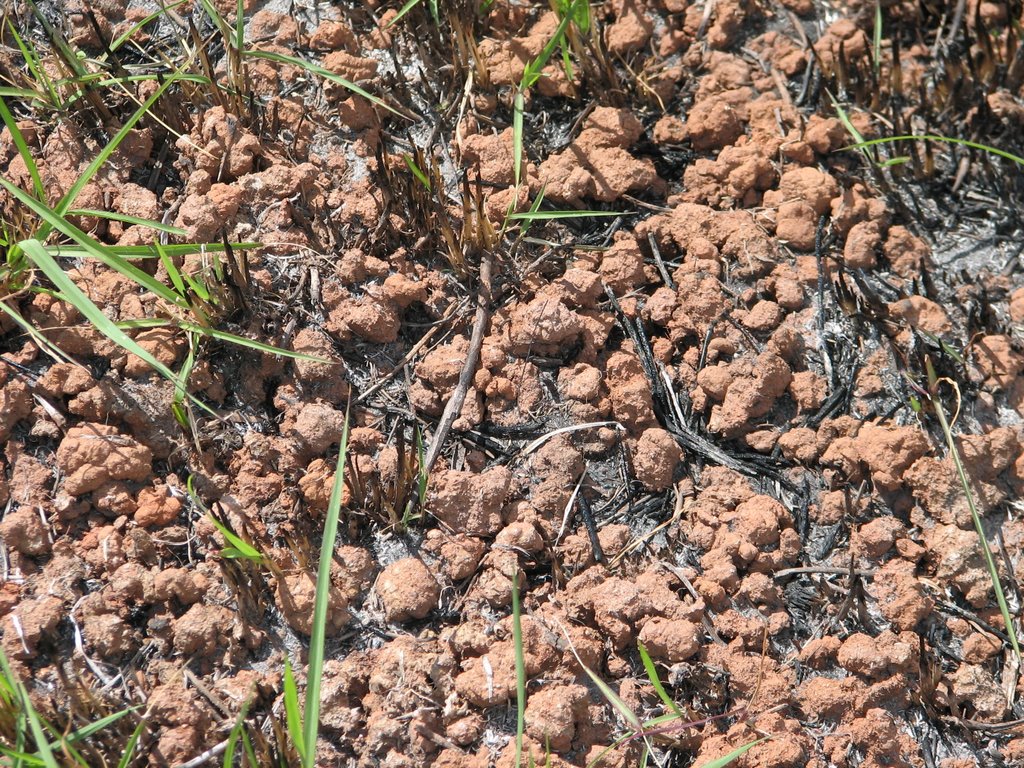
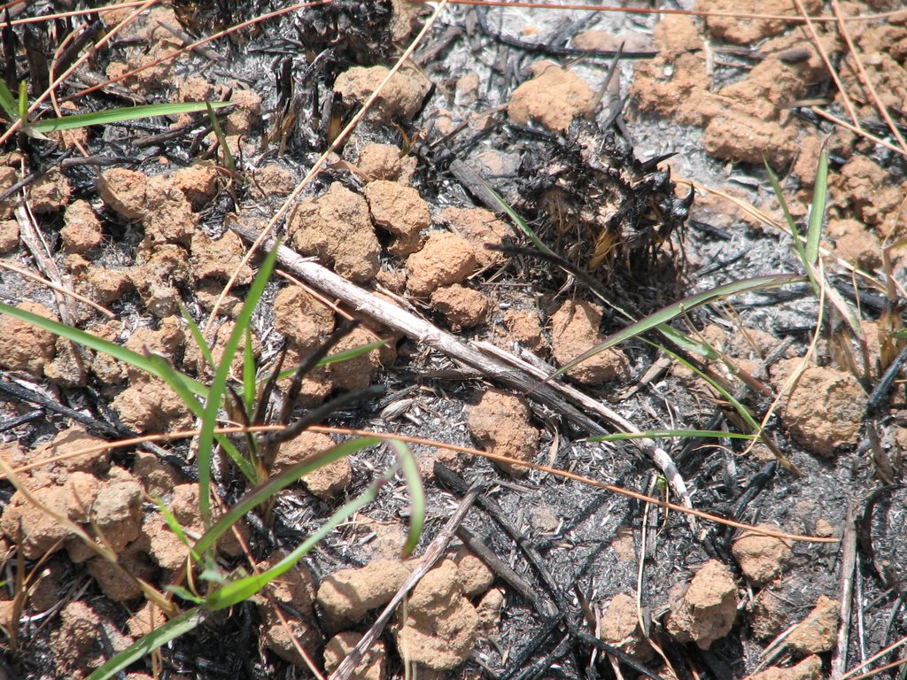
After the burning, the soil looks like this:


Those rocky looking things aren't rocks. They are what remains of the soil.
The fires competely dried out the soil and as a result the soil has started cracking. The fires have also caused the clay soil to form into small pellets (sorry for the lack of a better term). The pellets are very dry and hard, but crumble if you rub them between your fingers. They crunch under your feet as you walk through the charred remains of the vegetation. If I had to guess, I would say that there is almost no moisture in the soil (there might not be any).
The fires will have caused a series of chemical changes in the soil, too.
Brush fires can cause something called the hydrophobicity phenomena. This happens when something in burned organic matter decomposes to form a substance that creates an almost waterproof layer around soil.
Jeremy Shaw thinks this has happened at Lao Lao.
When the hydrophobcity phenomena occurs, soil is unable to soak up precipitation. When this happens, erosion rates increase dramatically due to the fact that course soils wash away much more easily than fine soils. This is especially true in locations with steeps slopes, such as the Lao Lao watershed.
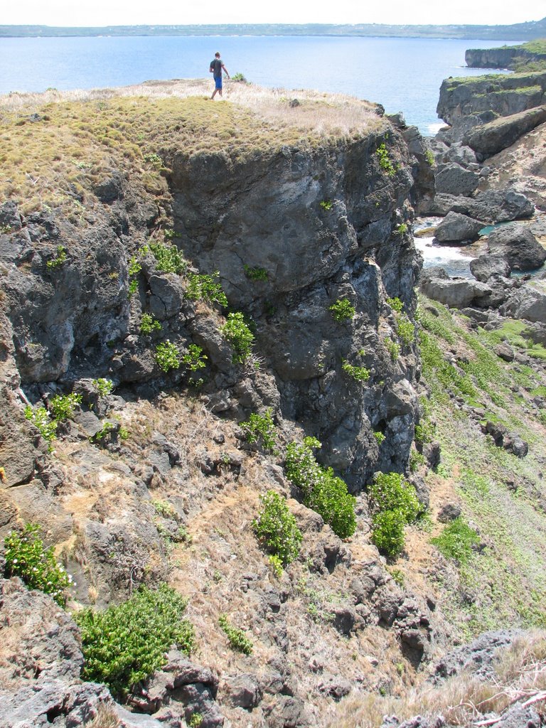
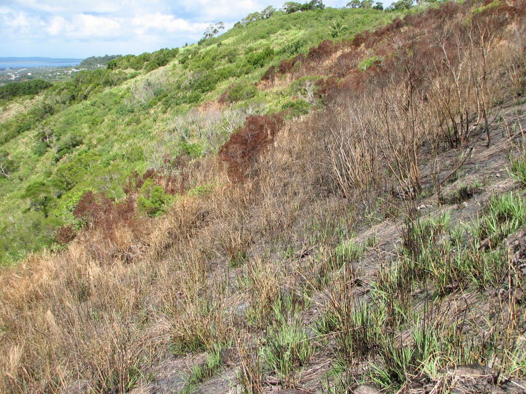
Just how steep are the slopes at Lao Lao? Maybe this photo will help illustrate:
 Those slopes are very steep. When it starts raining, anything not held in place by vegetation or some type of other mechanism will flow straight into the streams draining the watershed. From there it ends up on the reef flats and causes a whole host of problems.
In the following photo, Jeremy Shaw is kicking up the charred soil:
 In addition to charred soil, Jeremy is also kicking up a lot of the ash and other charred organic materials. He thinks that once the Green Season arrives that this additional input of sediment will cause even more problems downstream and out on the coral reefs.
So how did this all happen? Was it an act of God? Was it an accident?
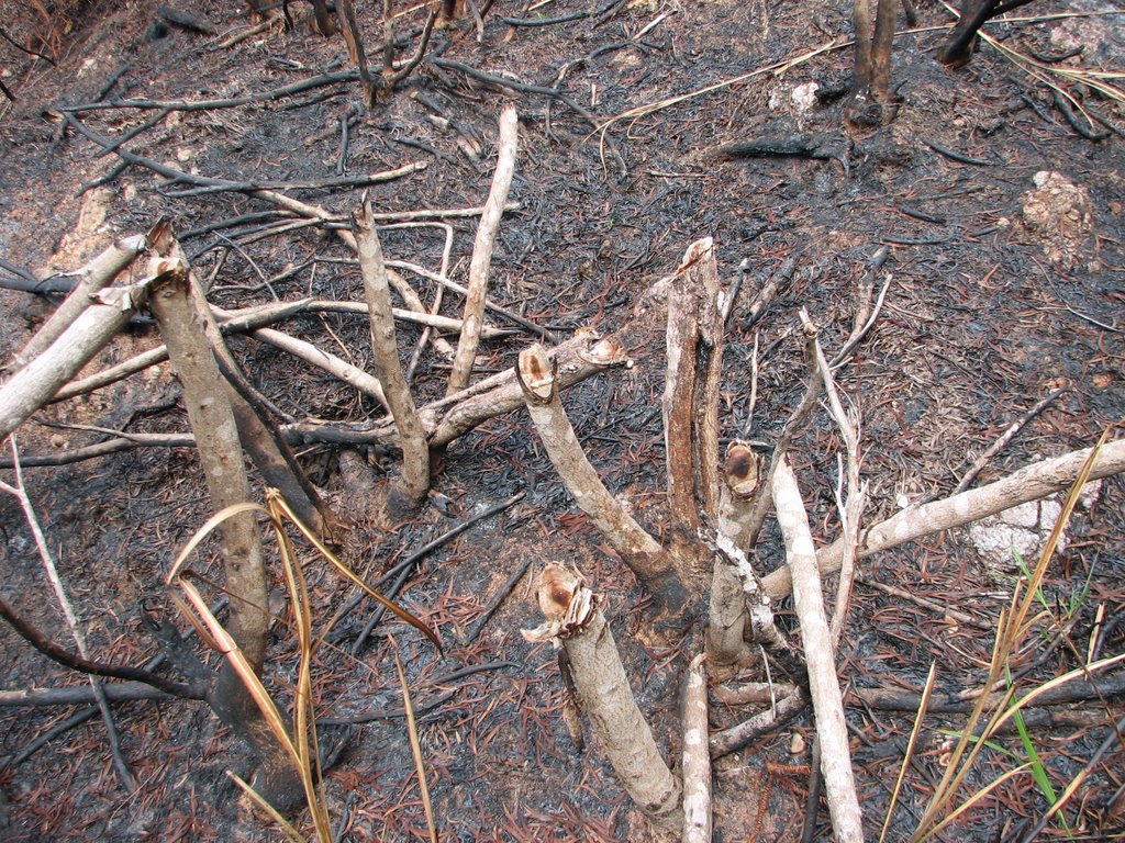
My best guess would have to be arson. Slash and burn has been a technique for clearing land on Saipan (and around the world) for centuries. When clearing with slash and burn techniques, a person clearing some land cuts down a few trees in an area. Then the felled trees are allowed to dry and are set ablaze. The fire burns until it runs out of fuel or until it reaches vegetation that is not dry enough to burn.
It has been a few weeks since the first burn, so it is difficult to see where it started and ended, because most of the ash has already washed away. The most recent burn, however, is still fresh enough to allow one to follow the path of charred vegetation
My best guess is that the most recent burn started just above the big water tank and then burned along the top of the ridge until it ran out of fuel.
I guess it is possible that the fire started at the top of the ridge and moved downhill, but it is much more likely that it started at the bottom of the ridge and moved uphill.
Guess what we found at the bottom of the ridge, where it looks like the fire originated:
 Is this proof that it was arson? Maybe. Or maybe not. Maybe someone was just cutting some firewood.
We have always hypothesized that hunters were burning the area to attract deer, which feed on the young swordgrass and tree shoots that pop up after the fire.
Well, guess what else we found:
 Is that what I think it is? Maybe. Or maybe not. Maybe someone's pet rabbit got loose.
We have called a special meeting to discuss what our next steps will be.
Nobody is pointing fingers, but if we want to be succesful, we NEED to stop the burnings.
That's all I'm going to say about that for now. I guess if anything, this new development will make our jobs a lot more interesting.
 Here is a photo (taken this week) of pretty much the same area after a recent burn:
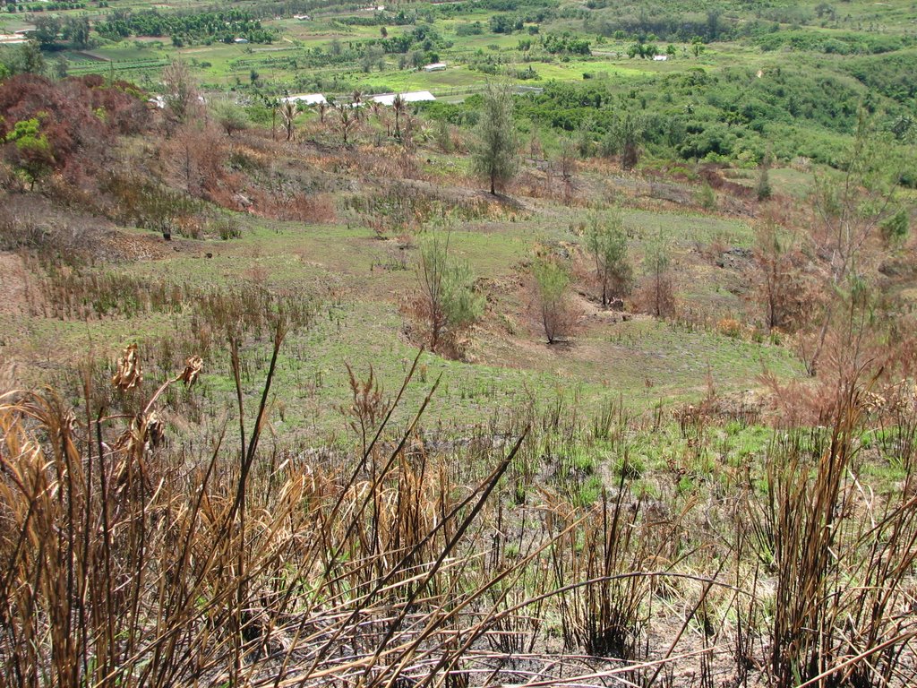 The first photo was taken just downhill from the second photo, but they both show pretty much the same spot. In the first photo, there are lots of grasses and a few trees covering the hill (but not much swordgrass). In the second photo, there is almost no cover and the trees look like they are dying. This area burned a few weeks ago.
At first glance, you might think that the post-burning photo looks nicer. The ground isn't covered by all those weeds and it looks like a pretty nice lawn (a lawn on an extremely steep slope).
Let's take a closer look
When I inspected the Lao Lao revegetation site a few weeks ago (on April 27, before the burnings), the soil looked like this:
 I'm not a soil scientist, but from the color, one can deduce that it is composed of mainly clay. Clay is made up of very fine particles. The soil looks dry, but it looks like it has some moisture (hence, the grass).
After the burning, the soil looks like this:
Those rocky looking things aren't rocks. They are what remains of the soil.
The fires competely dried out the soil and as a result the soil has started cracking. The fires have also caused the clay soil to form into small pellets (sorry for the lack of a better term). The pellets are very dry and hard, but crumble if you rub them between your fingers. They crunch under your feet as you walk through the charred remains of the vegetation. If I had to guess, I would say that there is almost no moisture in the soil (there might not be any).
The fires will have caused a series of chemical changes in the soil, too.
Brush fires can cause something called the hydrophobicity phenomena. This happens when something in burned organic matter decomposes to form a substance that creates an almost waterproof layer around soil.
Jeremy Shaw thinks this has happened at Lao Lao.
When the hydrophobcity phenomena occurs, soil is unable to soak up precipitation. When this happens, erosion rates increase dramatically due to the fact that course soils wash away much more easily than fine soils. This is especially true in locations with steeps slopes, such as the Lao Lao watershed.
Just how steep are the slopes at Lao Lao? Maybe this photo will help illustrate:
 Those slopes are very steep. When it starts raining, anything not held in place by vegetation or some type of other mechanism will flow straight into the streams draining the watershed. From there it ends up on the reef flats and causes a whole host of problems.
In the following photo, Jeremy Shaw is kicking up the charred soil:
 In addition to charred soil, Jeremy is also kicking up a lot of the ash and other charred organic materials. He thinks that once the Green Season arrives that this additional input of sediment will cause even more problems downstream and out on the coral reefs.
So how did this all happen? Was it an act of God? Was it an accident?
My best guess would have to be arson. Slash and burn has been a technique for clearing land on Saipan (and around the world) for centuries. When clearing with slash and burn techniques, a person clearing some land cuts down a few trees in an area. Then the felled trees are allowed to dry and are set ablaze. The fire burns until it runs out of fuel or until it reaches vegetation that is not dry enough to burn.
It has been a few weeks since the first burn, so it is difficult to see where it started and ended, because most of the ash has already washed away. The most recent burn, however, is still fresh enough to allow one to follow the path of charred vegetation
My best guess is that the most recent burn started just above the big water tank and then burned along the top of the ridge until it ran out of fuel.
I guess it is possible that the fire started at the top of the ridge and moved downhill, but it is much more likely that it started at the bottom of the ridge and moved uphill.
Guess what we found at the bottom of the ridge, where it looks like the fire originated:
 Is this proof that it was arson? Maybe. Or maybe not. Maybe someone was just cutting some firewood.
We have always hypothesized that hunters were burning the area to attract deer, which feed on the young swordgrass and tree shoots that pop up after the fire.
Well, guess what else we found:
 Is that what I think it is? Maybe. Or maybe not. Maybe someone's pet rabbit got loose.
We have called a special meeting to discuss what our next steps will be.
Nobody is pointing fingers, but if we want to be succesful, we NEED to stop the burnings.
That's all I'm going to say about that for now. I guess if anything, this new development will make our jobs a lot more interesting.
Wednesday, May 24, 2006
But is it healthy?
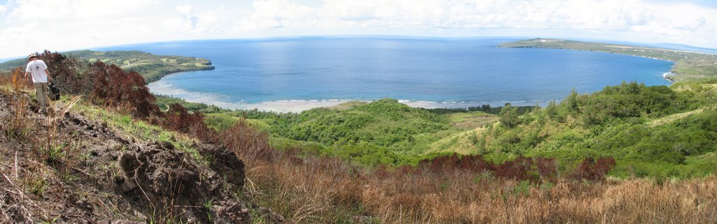 This is a panoramic view of Lao Lao bay, looking down from the top of the revegetation area. I don't think anyone would argue that this is not a beautiful site.
I mentioned in the previous post that someone recently burned the area. I was incorrect. Somebody recently burned the area TWICE. The first fire was a few weeks ago and the second fire was probably about a week ago.
Those burnings are going to have an immense impact on Lao Lao Bay as soon as the Green Season, and the rain that accompanies it, arrives.
So it may be beautiful now, but if we get hit by a typhoon this year, well, let's just hope that we don't get hit by a typhoon.
This is going to make our job a lot more difficult. I'll explain more in the next few posts.
Tuesday, May 23, 2006
Lao Lao Burning and Stream Stakeouts
The Lao Lao planting site has recently been burned. The burn area looks very large. I haven't seen it up close, but here are a few pictures taken from the public road below the revegetation area:
 This photo was taken from the South side of the burned area. Clicking on the photo will enlarge it. You can see how the trees that run along the highest ridge are completely charred.
 This photo was taken from the Lao Lao Dive Site, which is just north of the burned area. Clicking on the Photo will enlarge it. You can see that the highest peak is charred and that the burning extends to the left. We think that the burning extends onto the other side of the peak, too.
I am going up there tomorrow with Jeremy Shaw from DEQ to get a closer look. I'll post some pictures either tomorrow or in the next couple of days.
I was down at Lao Lao today because I was helping Jeremy inspect the stream beds in the Lao Lao watershed for suitable water quality sample sites.
Nine streams drain the Lao Lao watershed. Some of the streams are more accessible than others, so we need to find locations that will be safe and easy for volunteers to access.
There is a coral aggregate road in Lao Lao that runs down from San Vicente, then parallel to the beach, then finally up to Kagman. The nine streams are numbered 1-9 from South to North along this road. With the exception of Stream 1, all of the streams cross this road (Stream 1 runs parallel to the road). We want to sample each of the streams upstream of the road and then downstream of the road. That will give us an idea of which streams are dumping the most sediment into Lao Lao Bay and whether or not the sediment is coming from the road or from further up in the watershed.
Some of the streams drain the revegetation area (the recently burned revegetation area) and some of the streams drain vegetated areas. Streams 1 and 9 probably drain the coral aggregate roads that they parallel. Once we collect all of our data, we'll have an idea of how much sediment would naturally flow into Lao Lao, how much sediment is added to the water when the upland areas are burned and/or non-vegetated, and how much sediment coral aggregate roads add to stormwater.
This information will eventually help guide us towards the Best Management Practices to protect the coral reefs from stormwater runoff.
I took several pictures of the stream beds, but the only ones that came out clear were the ones from Stream 1. So here a few pictures from Stream 1:
 Stream 1 runs parallel to the road as it heads downhill towards the beach. Clicking on the photo will enlarge it. The road makes a left close to the bottom, but the stream continues straight towards the ocean. This picture visualizes rather well how any sediment carried in the stormwater is carried straight into Lao Lao Bay.
 This photo was taken from the edge of the water, looking back up towards the stream bed. Clicking on the photo will enlarge it. It takes a lot of fast moving water to cut a path like that. You can see how the vegetation covers the stream bed just past the small cliffs. The resulting shade makes photography difficult.
 This photo was taken from the South side of the burned area. Clicking on the photo will enlarge it. You can see how the trees that run along the highest ridge are completely charred.
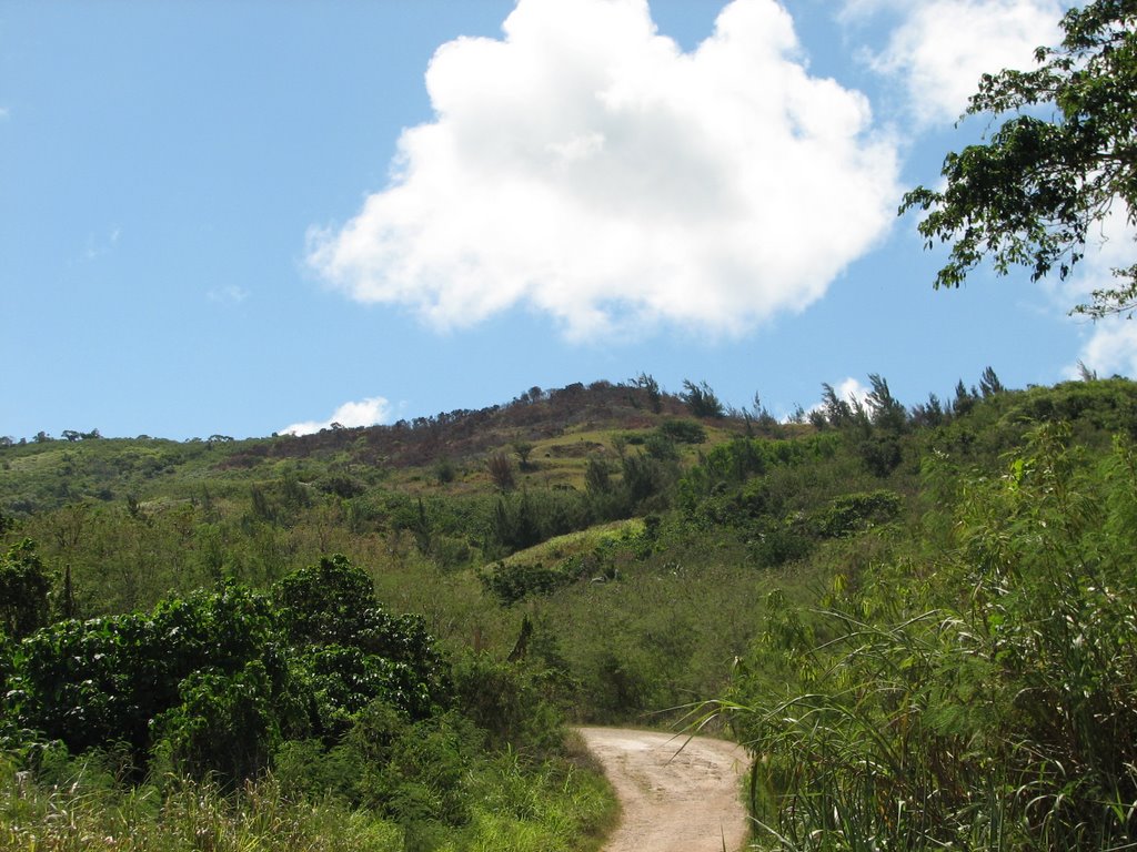 This photo was taken from the Lao Lao Dive Site, which is just north of the burned area. Clicking on the Photo will enlarge it. You can see that the highest peak is charred and that the burning extends to the left. We think that the burning extends onto the other side of the peak, too.
I am going up there tomorrow with Jeremy Shaw from DEQ to get a closer look. I'll post some pictures either tomorrow or in the next couple of days.
I was down at Lao Lao today because I was helping Jeremy inspect the stream beds in the Lao Lao watershed for suitable water quality sample sites.
Nine streams drain the Lao Lao watershed. Some of the streams are more accessible than others, so we need to find locations that will be safe and easy for volunteers to access.
There is a coral aggregate road in Lao Lao that runs down from San Vicente, then parallel to the beach, then finally up to Kagman. The nine streams are numbered 1-9 from South to North along this road. With the exception of Stream 1, all of the streams cross this road (Stream 1 runs parallel to the road). We want to sample each of the streams upstream of the road and then downstream of the road. That will give us an idea of which streams are dumping the most sediment into Lao Lao Bay and whether or not the sediment is coming from the road or from further up in the watershed.
Some of the streams drain the revegetation area (the recently burned revegetation area) and some of the streams drain vegetated areas. Streams 1 and 9 probably drain the coral aggregate roads that they parallel. Once we collect all of our data, we'll have an idea of how much sediment would naturally flow into Lao Lao, how much sediment is added to the water when the upland areas are burned and/or non-vegetated, and how much sediment coral aggregate roads add to stormwater.
This information will eventually help guide us towards the Best Management Practices to protect the coral reefs from stormwater runoff.
I took several pictures of the stream beds, but the only ones that came out clear were the ones from Stream 1. So here a few pictures from Stream 1:
 Stream 1 runs parallel to the road as it heads downhill towards the beach. Clicking on the photo will enlarge it. The road makes a left close to the bottom, but the stream continues straight towards the ocean. This picture visualizes rather well how any sediment carried in the stormwater is carried straight into Lao Lao Bay.
 This photo was taken from the edge of the water, looking back up towards the stream bed. Clicking on the photo will enlarge it. It takes a lot of fast moving water to cut a path like that. You can see how the vegetation covers the stream bed just past the small cliffs. The resulting shade makes photography difficult.
Volunteer Opportunity with DFW
The DFW Wildlife Section is soliciting mature reliable volunteers to work with us as part of a Wildlife Volunteer Corp.
The Wildlife Section is looking for dedicated people who would like to become a part of the conservation wildlife work that is going on with endangered species in the CNMI. Currently the division has two dedicated volunteers that have worked with the Division since 2001 on the Managaha Shearwater project. They have been invaluable in ensuring that this monitoring program continues. Currently, the Division would like to expand it’s volunteer corps by recruiting volunteers to work on the Mariana Swiftlet Project.
Mariana Swiftlets are endemic to the Mariana islands, an endangered species that live in caves. They once occurred on Rota but were extirpated in the 1970’s. There is a very small population of Mariana Swiftlets in Guam on the Naval Magazine.
The Division conducts surveys 2 times a year of Mariana Swiftlets at their caves while they enter in the evening. This survey is part of a long term (13 years) Mariana Swiftlet monitoring program.
We are looking for a few people to donate 2-4 evenings (about 4 hours each) two times a year, in April and October to assist wildlife staff in counting swiftlets at their caves. We would like to have volunteers by October 2005 so they could be trained by apprenticing with wildlife staff. We want volunteers who feel they could make a commitment for several years as training requires additional time and effort that would be wasted if there were not a few year commitment.
Interested persons can contact Laura Williams at 323-6003 or 483-9453 or by email at lwilliams@itecnmi.com.
Please feel free to pass this along to individuals who may be interested. Thanks!
Monday, May 22, 2006
Want to Help?
The best way to help our coral reef outreach program RIGHT NOW is to help us increase our Internet presence. The best way to do that is to add a link to this blog in your livejournal, myspace blog, blogger, or personal website and/or blog.
Then, after you add a link to our blog, go to Ping-o-Matic and ping all of the blog services there. All you have to do is type in the name of your blog, your blog home page URL (don't worry about the RSS URL), check the services that you want to ping (all of them), and then click on the "Send Pings" button.
The blog services will see that you updated your blog and will make note that you have added a link to us. The more websites and blogs that link to this blog, the higher we will appear in search engine results.
We are already the #2 result for a google search of "Hafa Adai Saipan."
Won't you help us become #1?
We appreciate your help, but whatever you do, please DO NOT send out a mass email asking your contacts to link to us or to read our blog. That is SPAM. Nobody likes SPAM....well, forget it, I won't even go there.
Sunday, May 21, 2006
Saipan's Newest Website
This is the unofficial blog for the Marianas RC&D for at least the next year. The point of this blog is to give a day to day report on our year long Coral Reef Outreach project.
We will also have a traditional format website that will be used to disseminate the information gathered throughout the year. While the blog is meant to be an enjoyable read, the website will be more of a resource for people looking for information on Saipan's coral reefs and Saipan in general.
I reserved the url for the traditional website today.
The url is:
www.hafa-adai.org
It will be a day or two before it is available online. I'm going to have the website redirect to this blog while I am writing the code (i.e. while the website is under construction, people will be redirected to this blog).
I'll report on this blog when the website is ready.
Wednesday, May 17, 2006
Socioeconomic Survey
In addition to the volunteer activities outlined in the previous posts, this project calls for the completion of a socioeconomic survey that will gauge the local public's understanding of Marine Protected Areas, fisheries, and other rules and regulations, attitudes and beliefs towards coral reef value, conservation, and management, as well as the level of satisfaction of stakeholders with participation in government measures, local fisher perceptions of catch amounts, and local use patterns of coral reef resources. The survey will also gauge the public's uderstanding of human impacts on coral reef ecosystems. The project calls for the survey to be conducted once at the start of the year and to be repeated a second time at the end of the year.
Marianas RC&D has been working with Steve Leopoldo, the Lead Analyst at Fako & Associates, Inc., a polling firm based out of suburban Chicago, to create and implement the survey. Mr. Leopoldo helped us develop the survey and offered expertise on the proper protocals for conducting a scientific survey.
The pre-survey is being conducted right now.
Mr. Leopoldo has provided his services as an in-kind contribution.
Thanks, Mr. Leopoldo. You get a gold star.
Thursday, May 04, 2006
Photos from Lau Lau Bay
Mark Robertson shared some of his underwater photography with me to post on this blog. Click HERE to see more of his photos.
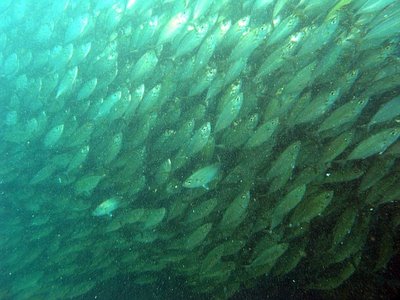
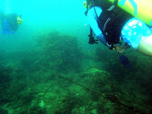
These first two photos illustrate the level of sedimentation near the shore. In the first photo, the divers are heading out into deeper water along the American Rope. In the second photo, a school of Bigeye Scad (Selar crumenophthalmus) check out the divers.

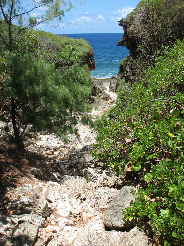
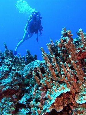
 Although the visibility is very low near shore, further out the water clears up and the diving is amazing:
 It is unfortunate that divers have to swim through the water in the first two photos to get to the water from the third photo, but we expect the revegetation project to cut down on the amount of sediment, so things will get better.
These first two photos illustrate the level of sedimentation near the shore. In the first photo, the divers are heading out into deeper water along the American Rope. In the second photo, a school of Bigeye Scad (Selar crumenophthalmus) check out the divers.
 Although the visibility is very low near shore, further out the water clears up and the diving is amazing:
 It is unfortunate that divers have to swim through the water in the first two photos to get to the water from the third photo, but we expect the revegetation project to cut down on the amount of sediment, so things will get better.
Monday, May 01, 2006
Preliminary Lau Lau Assessment
This post is meant to give the reader an introduction to the Lau Lau watershed, some of the problems facing the area, who the stakeholders in the area are, and some potential solutions to the problems.
Here is a photo of Saipan's watersheds, taken from the Coastal Resources Management website:
 As you can see from the photo, the Lau Lau watershed drains into Lau Lau Bay (also called Magicienne Bay).
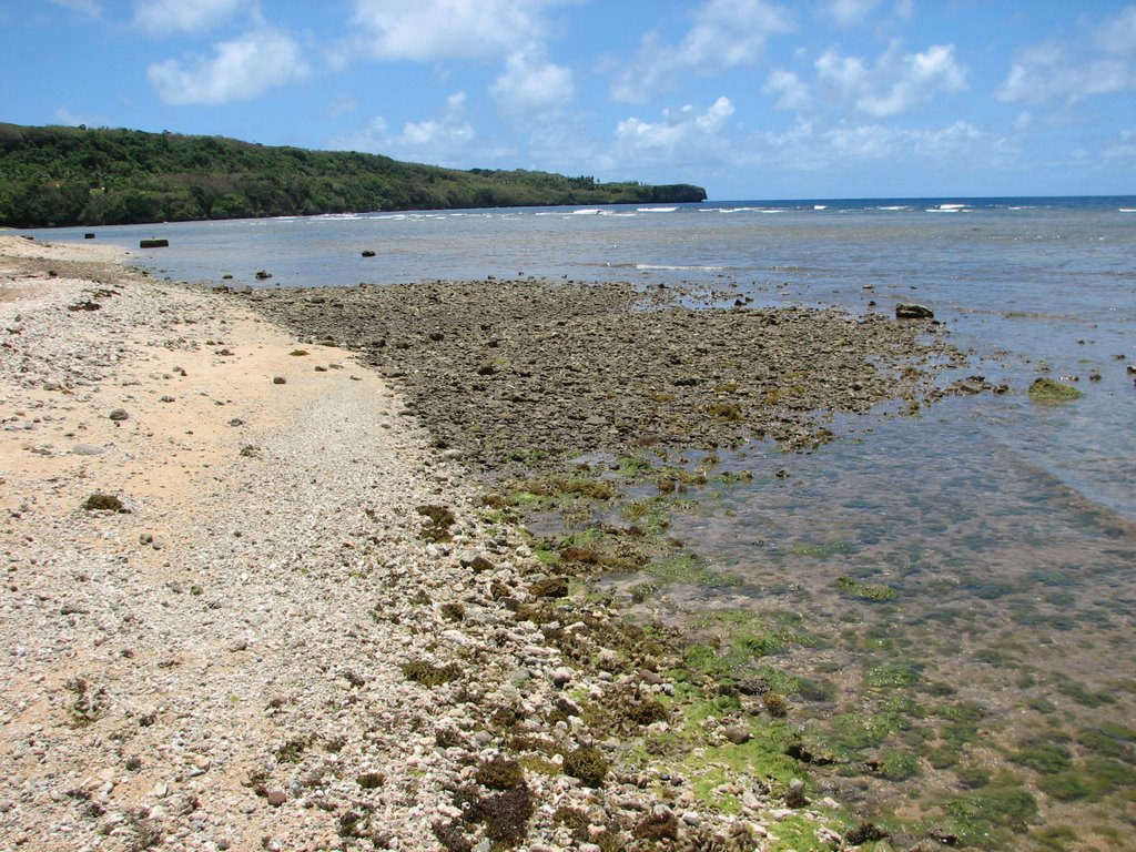
The area has a serious problem with sediment runoff, which reduces visibility and promotes the growth of turf algae and macroalgae, which compete with coral growth. I experienced this first hand during my dive last week. The water clears up the further from shore you swim, but close to shore the visibility is very bad. It is almost zero at the point of entry.
Lau Lau Bay is one of the most popular diving sites on Saipan. A recent study by Pieter van Beukering et al estimates that marine ecosystem associated water sport activities on Saipan, including diving and snorkeling, add $5.77 million to the local economy. Improving the water quality at the site would be an important step in ensuring that this source of revenue is sustained.
Here are a few pictures of the shoreline (I do not have an underwater casing for my camera yet, so it will be a little while before I can show you some underwater pictures):
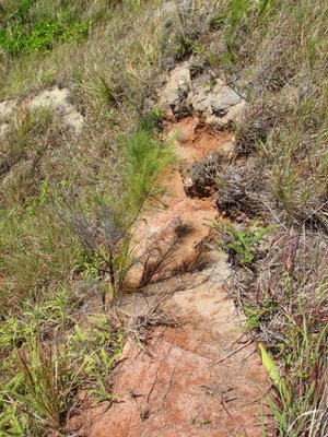
 This is the outlet for one of the streams draining the Lau Lau watershed. You can see how the sediment has built up to form a small delta. You can also see some of the algae growing on the rocks. I have been told that during the rainy season, this delta extends much further out into the water.
 Close up of some algae during low tide. This picture was taken right next to the delta in the previous photo.
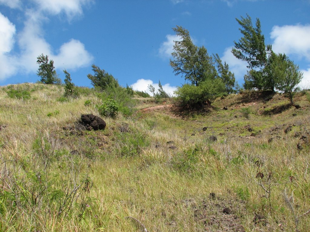
It is generally agreed upon that sediment runoff is causing the poor visibility and algae blooms. The Department of Environmental Quality has identified "upland burning and clearing for development, farming, and even hunting over the years" as the major source of "brown runoff." Click HERE for more DEQ information on brown runoff and the Talakhaya watershed in Rota. It is also believed that Gap Gap Road and some of the stream crossings are adding to the sediment load.
Here is a picture of Gap Gap Road and of some of the upland deforested areas:


It would be great if the solution to this problem were as simple as fixing the road and planting some trees, but as with most things in life, things are a bit more complicated than that.
First of all, most of the top soil has already washed into the bay. Some work has already been done to determine what types of trees will grow in the remaining substrate, but only a field test will let us know for sure what we can grow there.
Also, if we went ahead and simply planted more trees, there is no guarantee that they wouldn't be burned the following dry season. It is believed that local hunters burn the area to, initially, flush deer during the hunt, and secondly, to promote the growth of new saplings, which attract grazing deer later in the season.
Since they play such an important part in the health of Saipan's coral reefs, it will be important to involve hunters in any decision making activities. The questions that need to be asked are how can we stop the erosion without infringing on the hunters right to hunt and are there more sustainable ways to hunt and to attract deer?
The answers probably lie with the fact that most hunters on this island are also fishermen. The health of the reefs, which are directly affected by their hunting activities, should be as important to them as it is to the dive shop owners, who make a living bringing tourists to dive in Lau Lau. As for the dive shop owners, they should view any efforts to improve the water quality in Lau Lau as an investment in their business. Since there are non-profit groups involved in these activities, any investment of time or resources that they make is a tax-deductable business expense. It is a win-win situation for them.
We will also have to work with the understanding that most of the area is privately owned. We will have to work with the land owners in order to determine what they can and are willing to do and what they will allow us to do.
Well, I guess this is a start. We are still in the process of figuring out the types of activities that would be best suited for volunteers and I'm still trying to meet everybody on this island who is involved in coral reef conservation and development.
I'll keep you updated as developments happen, but in the meantime, please bookmark this url and/or add a link to us from your blog or personal website.
As I mentioned at the start of this post, a blog is not the best place to give a dissertation on the interaction of hydrology, biology, ecology, and anthropogenic disturbances in Lau Lau Bay. I think that a traditional format website (or a research paper!) would be a better outlet for such information, and I promise that such a website is in the works. In the meantime, several other groups and government agencies have published information on Lau Lau Bay.
Here are a few of them:
DEQ Info
DEQ Volunteer Reef Flat Monitoring in Lau Lau
EPA NPS Pollution Success Stories
Shorediving.com Review of Lau Lau
Great Shot of the Bay from CNMI Guide
Here is a photo of Saipan's watersheds, taken from the Coastal Resources Management website:
 As you can see from the photo, the Lau Lau watershed drains into Lau Lau Bay (also called Magicienne Bay).
The area has a serious problem with sediment runoff, which reduces visibility and promotes the growth of turf algae and macroalgae, which compete with coral growth. I experienced this first hand during my dive last week. The water clears up the further from shore you swim, but close to shore the visibility is very bad. It is almost zero at the point of entry.
Lau Lau Bay is one of the most popular diving sites on Saipan. A recent study by Pieter van Beukering et al estimates that marine ecosystem associated water sport activities on Saipan, including diving and snorkeling, add $5.77 million to the local economy. Improving the water quality at the site would be an important step in ensuring that this source of revenue is sustained.
Here are a few pictures of the shoreline (I do not have an underwater casing for my camera yet, so it will be a little while before I can show you some underwater pictures):
 This is the outlet for one of the streams draining the Lau Lau watershed. You can see how the sediment has built up to form a small delta. You can also see some of the algae growing on the rocks. I have been told that during the rainy season, this delta extends much further out into the water.
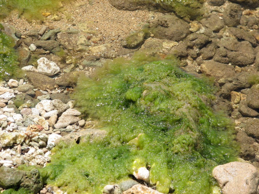 Close up of some algae during low tide. This picture was taken right next to the delta in the previous photo.
It is generally agreed upon that sediment runoff is causing the poor visibility and algae blooms. The Department of Environmental Quality has identified "upland burning and clearing for development, farming, and even hunting over the years" as the major source of "brown runoff." Click HERE for more DEQ information on brown runoff and the Talakhaya watershed in Rota. It is also believed that Gap Gap Road and some of the stream crossings are adding to the sediment load.
Here is a picture of Gap Gap Road and of some of the upland deforested areas:


It would be great if the solution to this problem were as simple as fixing the road and planting some trees, but as with most things in life, things are a bit more complicated than that.
First of all, most of the top soil has already washed into the bay. Some work has already been done to determine what types of trees will grow in the remaining substrate, but only a field test will let us know for sure what we can grow there.
Also, if we went ahead and simply planted more trees, there is no guarantee that they wouldn't be burned the following dry season. It is believed that local hunters burn the area to, initially, flush deer during the hunt, and secondly, to promote the growth of new saplings, which attract grazing deer later in the season.
Since they play such an important part in the health of Saipan's coral reefs, it will be important to involve hunters in any decision making activities. The questions that need to be asked are how can we stop the erosion without infringing on the hunters right to hunt and are there more sustainable ways to hunt and to attract deer?
The answers probably lie with the fact that most hunters on this island are also fishermen. The health of the reefs, which are directly affected by their hunting activities, should be as important to them as it is to the dive shop owners, who make a living bringing tourists to dive in Lau Lau. As for the dive shop owners, they should view any efforts to improve the water quality in Lau Lau as an investment in their business. Since there are non-profit groups involved in these activities, any investment of time or resources that they make is a tax-deductable business expense. It is a win-win situation for them.
We will also have to work with the understanding that most of the area is privately owned. We will have to work with the land owners in order to determine what they can and are willing to do and what they will allow us to do.
Well, I guess this is a start. We are still in the process of figuring out the types of activities that would be best suited for volunteers and I'm still trying to meet everybody on this island who is involved in coral reef conservation and development.
I'll keep you updated as developments happen, but in the meantime, please bookmark this url and/or add a link to us from your blog or personal website.
As I mentioned at the start of this post, a blog is not the best place to give a dissertation on the interaction of hydrology, biology, ecology, and anthropogenic disturbances in Lau Lau Bay. I think that a traditional format website (or a research paper!) would be a better outlet for such information, and I promise that such a website is in the works. In the meantime, several other groups and government agencies have published information on Lau Lau Bay.
Here are a few of them:
DEQ Info
DEQ Volunteer Reef Flat Monitoring in Lau Lau
EPA NPS Pollution Success Stories
Shorediving.com Review of Lau Lau
Great Shot of the Bay from CNMI Guide
Subscribe to:
Posts (Atom)
