You see, if you had looked on Google Earth for Saipan or any of the other Northern Mariana Islands only 49 hours ago, you would have seen a string of smudgy green dots several thousand miles southeast of Japan.
Not anymore.
Now Google Earth has high definition satellite pictures covering every single island in the Archipelago...from Guam to Maug.
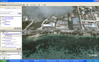
We can use this completely FREE online tool to look at the Marianas Resource Conservation & Development Council Office on Beach Road:
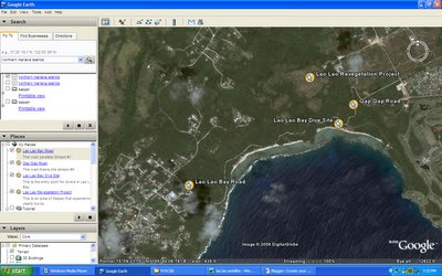
 But even better, we can use it to make satellite images of the areas on island where we are working. Like, let's say, Lao Lao Bay:
 I've marked off the revegetation area (its the area currently not vegetated!), the dive site, the road draining into Stream #1(Lao Lao Bay Road), and the road draining into Stream #9(Gap Gap Road). This should help our off island readers visualize where we are working.
Technorati Tags: google earth, saipan

No comments:
Post a Comment