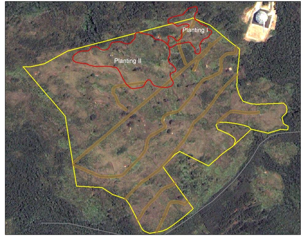
 This is the map of our three plantings. As I mentioned in the previous post, the area marked as Planting II actually encompasses our plantings from Thursday and Sunday. There was some overlap and they were only three days apart, so it made sense to combine them.
It is funny to think of all the labor that went into creating this single map. It took 157 volunteers carrying 471 saplings, 250 cuttings, 600 Putting seeds, 200 Kamachili seeds, and 4200 Tangantangan seeds up a mountain. It also took hours of planning, purchasing supplies, and of course the caring and propagation of all the trees.
We put a lot of effort into this project, but we wouldn't have had to do anything if somebody hadn't burned the area. Once we finish planting the rest of the trees, our next item on our agenda is to spend the next several months educating the public about the the affect of wildfires on our coral reefs. We need the public to understand that we have to stop the wildfires.

No comments:
Post a Comment