 This afternoon Coastal Resource Management GIS specialist Deirdre McClarin, who is funded through NOAA, helped us map out our plantings at the Lao Lao revegetation site. We created a boundary for the planting that we did two weeks ago and a boundary combining the two plantings we did this past week (they had some overlap and were only separated by 3 days, so it made sense to combine them).
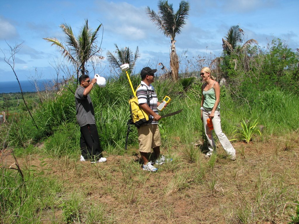
She had help from two interns, Eleno Valdez and Ray Camacho. To map out the area they used a Trimple GPS unit, which is a backpack with batteries and an antenna (for increased accuracy), and has the GPS 'computer' connected to it. The interns carried the GPS around the edge of both revegetation plots and logged position readings every five seconds.
Deirdre will plug that data into existing GIS data and will print us out a digital map of both planting areas. This data will be made available to the general public.

1 comment:
this is sweet! i can't wait to come back in 20 yrs and see the place completely jungle-ized! ha ha!
Post a Comment